
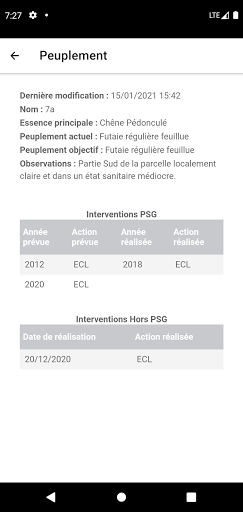
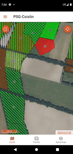
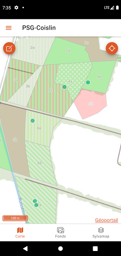
Features Sylvamap
Interactive cartography allowing to geolocate forest stands with their description and program of cuts and works.The application makes it possible to report reports following field observations.
🚗
Automotive
Manage and monitor your vehicle with smart features.
Screenshots
See the Sylvamap in Action
Get the App Today
Download on Google Play
Available for Android 8.0 and above